The entire Julius Anderson Photograph Collection is now online
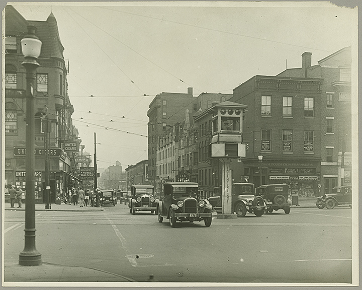
Station North before there was such a thing. Street scene. Intersection of Charles Street and North Avenue, ca.1920-1930. 1994-42-083, MdHS.
In order to raise awareness of our amazing photograph collections, the H. Furlong Baldwin Library at the Maryland Historical Society has entered into a partnership with our neighbors at Digital Maryland, a collaborative, statewide digitization program headquartered at the Enoch Pratt Free Library. The first project of the new partnership was to digitize an entire MdHS photograph collection. The Julius Anderson Photograph Collection was chosen in part because of its manageable size, but also because of its obvious appeal to researchers and lovers of all things Baltimore.
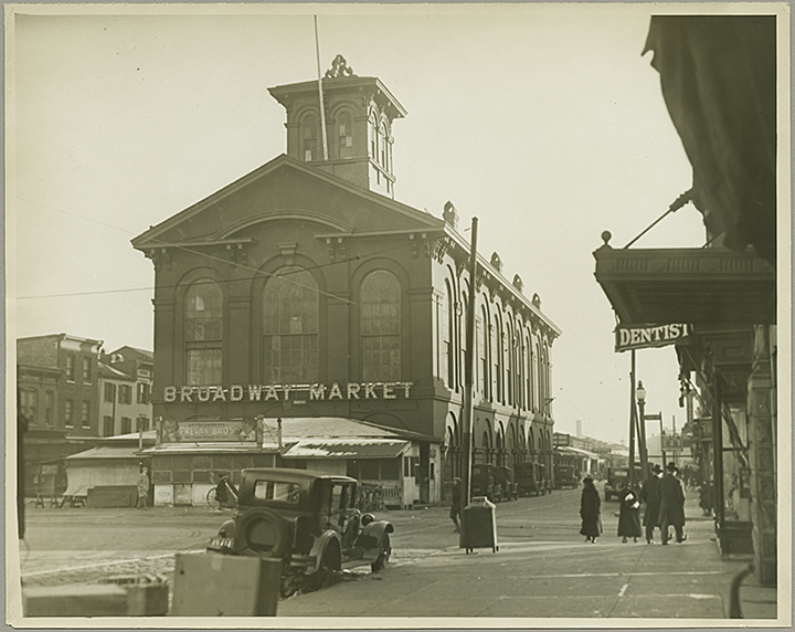
Pre-“Carmageddon” Fells Point. Although we’re willing to bet that residents complained about the streets back then as well. Street scene. Broadway Market, Broadway and Eastern Avenue, ca.1920-1930. 1995-62-102, MdHS.
The Julius Anderson collection consists of over two hundred 8×10 photo prints of historic Baltimore buildings and places photographed between the 1920s and ’40s. Many of the buildings have since been demolished but some remain standing and have been repurposed. The photographer’s identity in this collection is unknown as is the purpose of the photographs. Anderson acquired the collection and subsequently donated it to the Baltimore City Life Museum in 1994 and 1995, before it found its way to the Maryland Historical Society in 1998 when the BCLM folded.

In the latter half of the 19th century, this land belonged to the Dulin Family before they sold it to the Maryland Casualty Company. The firm moved into the building in 1922 and vacated in the late 1960s. After MCC vacated, architect Donald Lee Sickler was hired to turn it into a shopping mall, adding an extra 40,000 square feet. Named the Rotunda, the building opened in 1973 with a grocery, drugstore, cafeteria, and a movie theater. Street scene. Maryland Casualty Company (701 West 40th Street, ca.1920-1930. 1995-62-071, MdHS.
These 17 images are just the tip of the iceberg. The collection in its entirety can be viewed here at Digital Maryland as well as here on MdHS’s web site. Our hope is that it will be easier for people to find our images and then want to use them in books, documentaries, web sites, and any number of mediums. The modest permission fees that MdHS charges for usage helps us to preserve this collection and others like it. You can help. Please enjoy and share widely. (Joe Tropea)
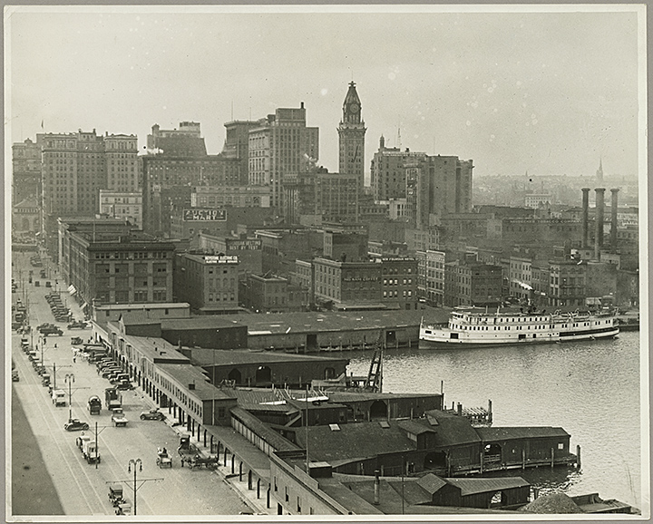
This view of the Inner Harbor features automobiles, horse-drawn wagons, an auction, the Keystone Electric Company, the New Fountain Hotel (122 East Pratt Street), the Neudecker Tobacco Company, and the American Oil Company. Elevated street and harbor view looking north-northeast along Light Street, ca.1920. 1995-62-038, MdHS.
—–
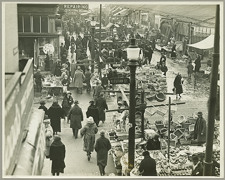
Old Lexington Market. Looking west on Lexington Street, at the corner of Eutaw Street. Street Scene (elevated view). Lexington Market, ca.1920-1930. 1995.062.060, MdHS.
—–

Baltimore City Jail, (Fallsway at Madison Street). The Maryland Penitentiary is visible behind the jail, ca.1920. 1995-62-035, MdHS.
—–

This building no longer exists. BCPD HQ was razed to connect the JFX to President Street. This was the northwest corner of Fallsway and Fayette Street. Baltimore City Police Department Headquarters. 100 Fallsway, ca.1920-1930. 1995-062-054, MdHS.
—–
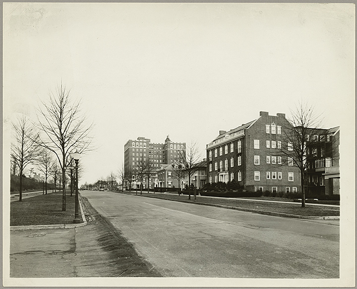
Charles Village before it was a bustling “College Town” with pizza by the slice and dedicated bike lanes. Street scene. Charles Street and West 32nd Street, c.1920. 1995-62-016-A, MdHS.
—–
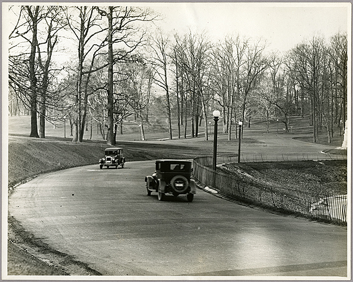
We know… remember when is the lowest form of conversation. But still, remember when you could drive a car around Druid Lake? Street scene. Automobiles along Druid Hill Park Reservoir, ca.1925. 1994.42.100, MdHS.
—–
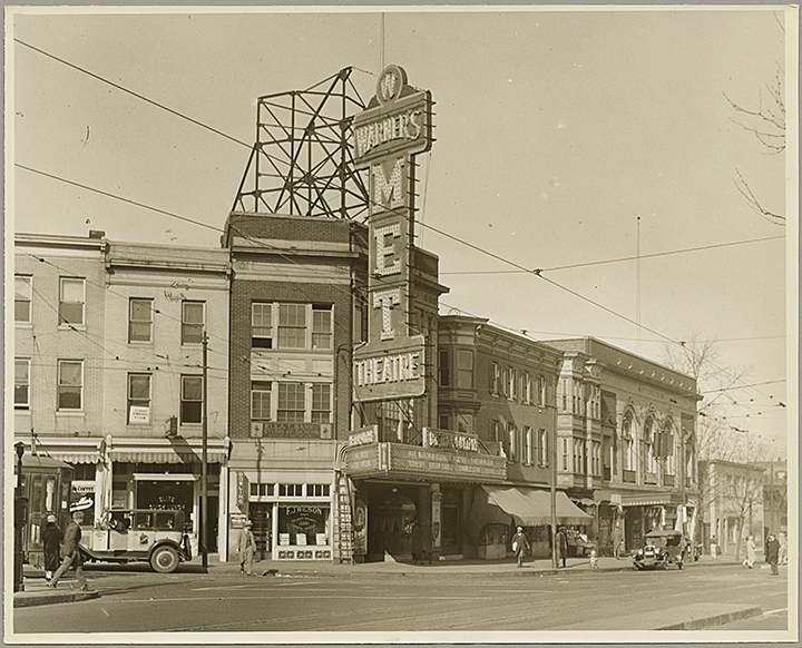
Street scene. Corner of Pennsylvania and North Avenues, ca.1922-1947. 1995-62-003, MdHS.
—–
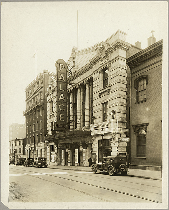
Street scene. The Palace Theatre (311-317 West Fayette Street), ca. 1920-1930. 1995-62-005, MdHS.
—–
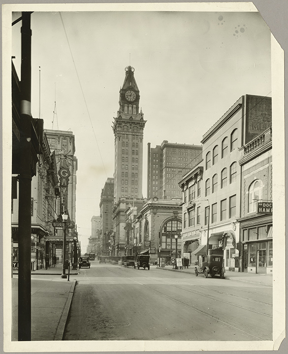
This shot shows the Hearst Tower—a.k.a. the Tower Building (originally built by Maryland Casualty Company which housed the Baltimore News-American), theNational Central Bank, Frank and Company Clothes, and more proof that street car lines were everywhere. Street scene. 400 block, East Baltimore Street, ca.1920-1930. 1995-62-006, MdHS.
—–
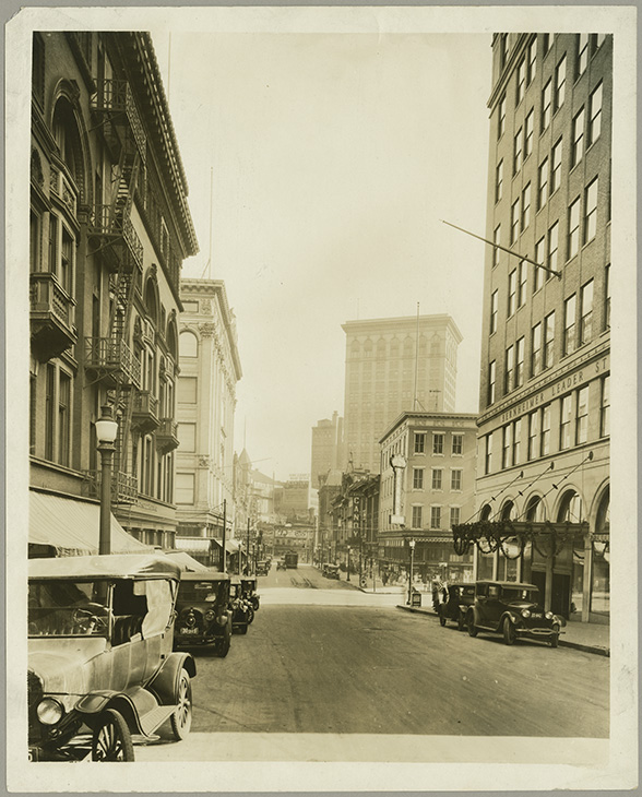
Once a bustling shopping district featuring Hochschild-Kohn, Stewart and Company, Berheimer-Leader Stores (later became the May Company), Read’s Drug Store, and the Century Theatre. Street scene. Looking east on Lexington Street, corner of Howard Street, ca.1920-1930. 1995-62-067, MdHS.
—–
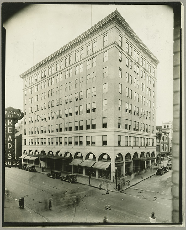
Street scene (elevated view). Bernheimer-Leader Stores, ca.1920-1930. 1995-62-059, MdHS.
—–

The northeast corner of Howard and Lexington Streets. Stewart and Company, ca.1926. 1994.42.036, MdHS.
—–

The northwest corner of Howard and Lexington Streets. Hochschild Kohn and Company department store, ca.1925. 1994-42-039, MdHS.
—–
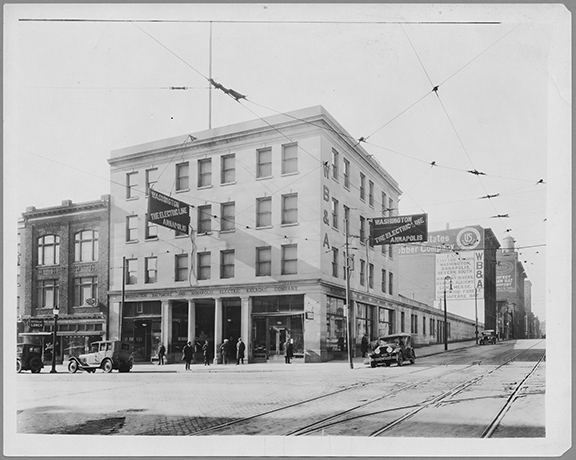
Howard Street at Lombard Street. The Washington, Baltimore, and Annapolis Electric Railroad Company (WB&A) terminal station, ca.1925. 1994-42-050, MdHS.